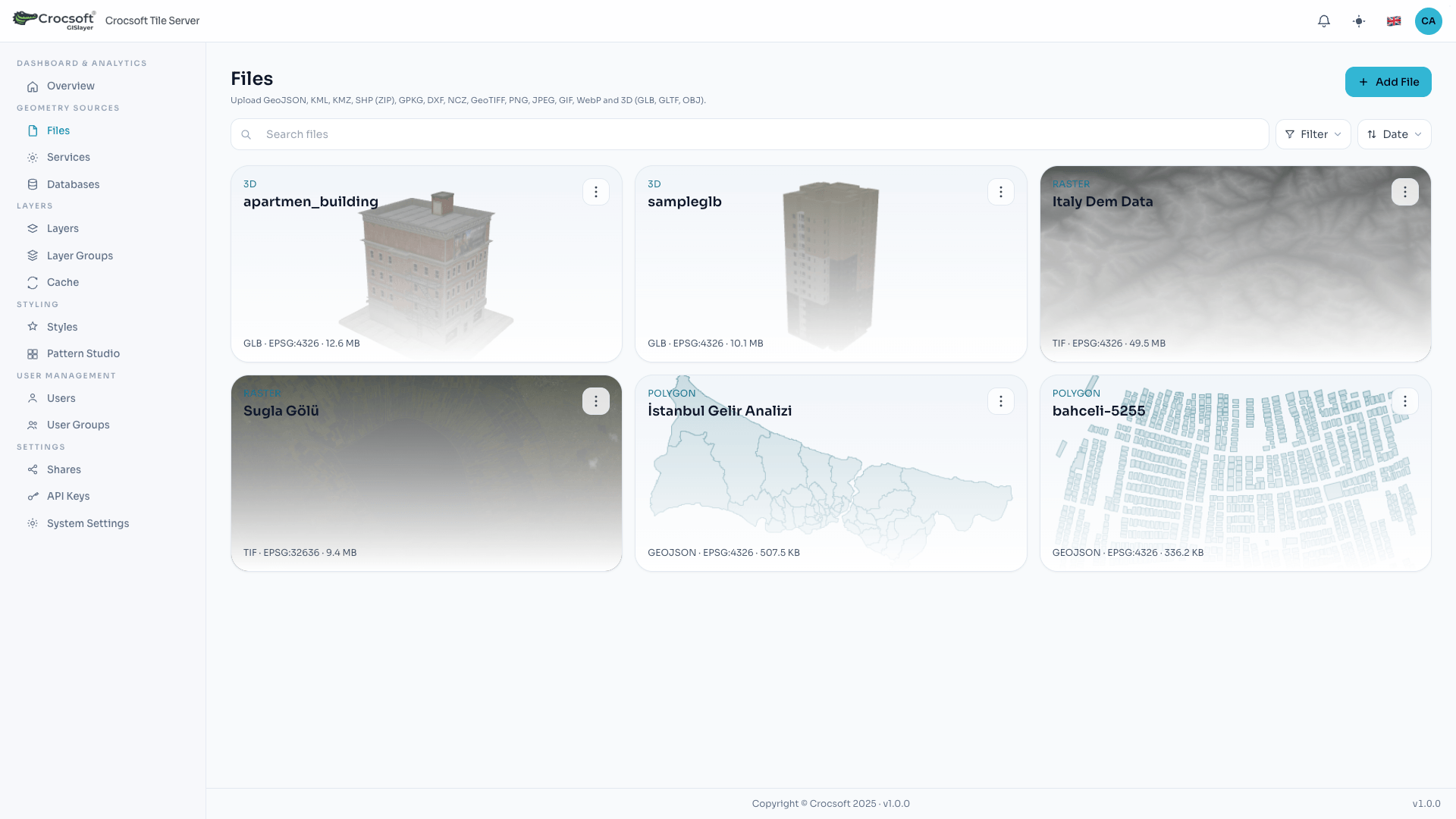
 Uploading geometric files and raster data into the system
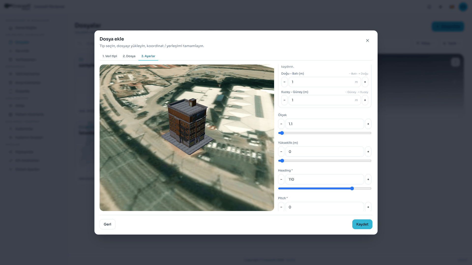 Uploading GLB, GLTF, and OBJ 3D data into the system
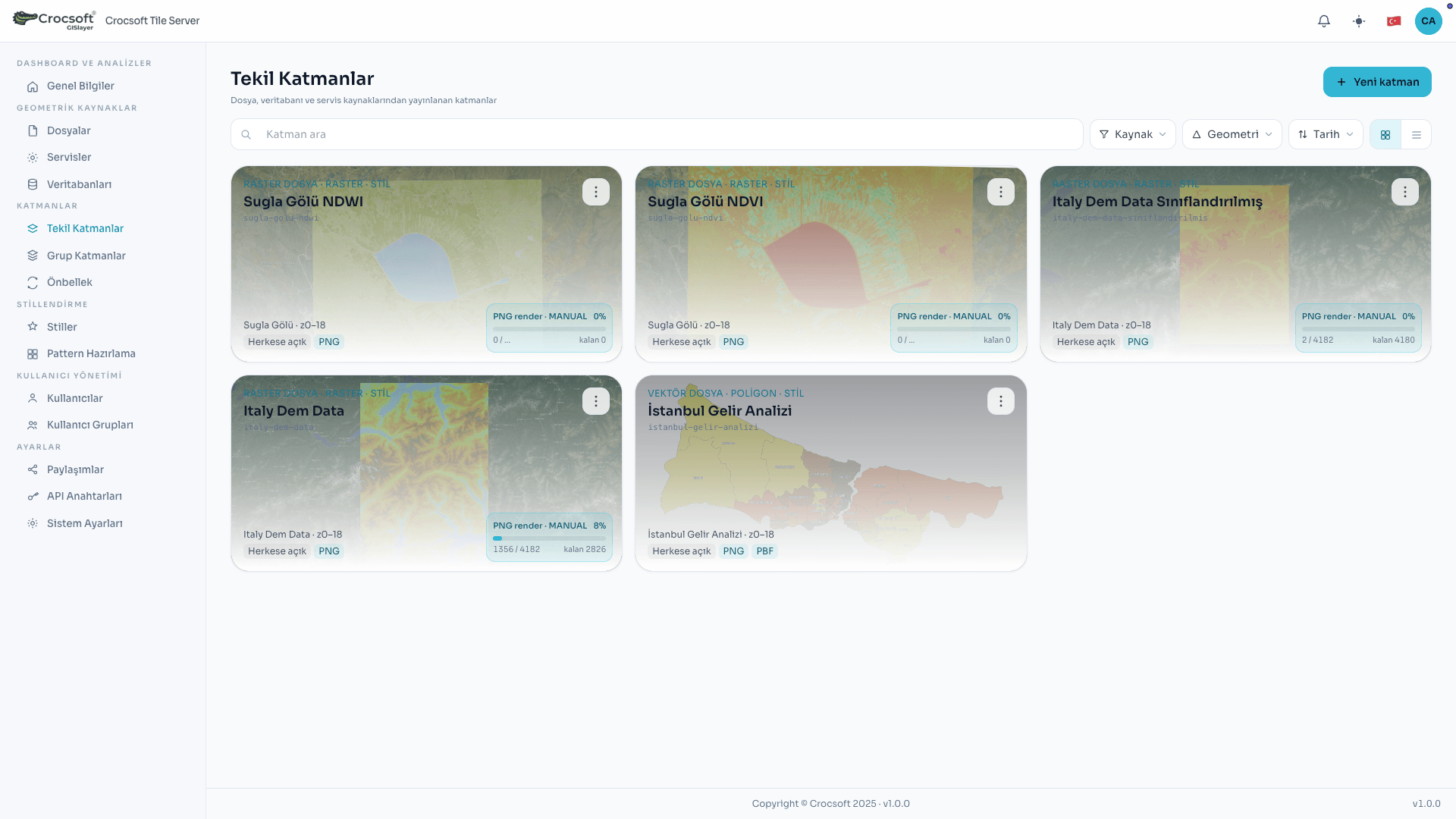 Adding data as layers
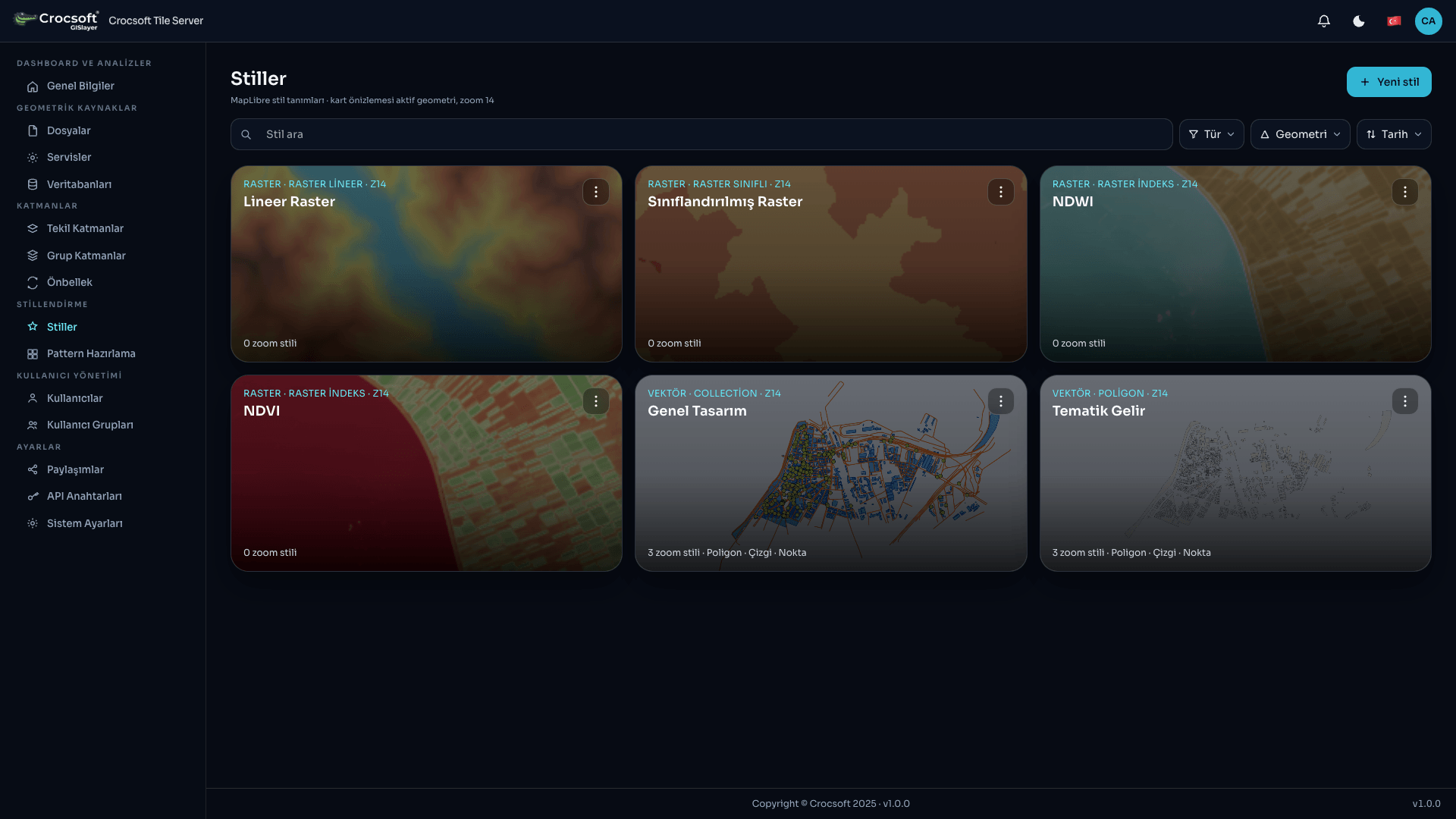 Style list and visualization
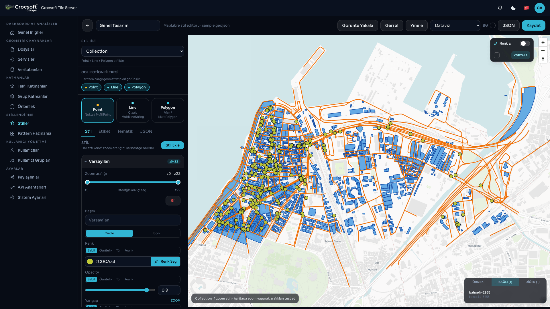 New style creation interface
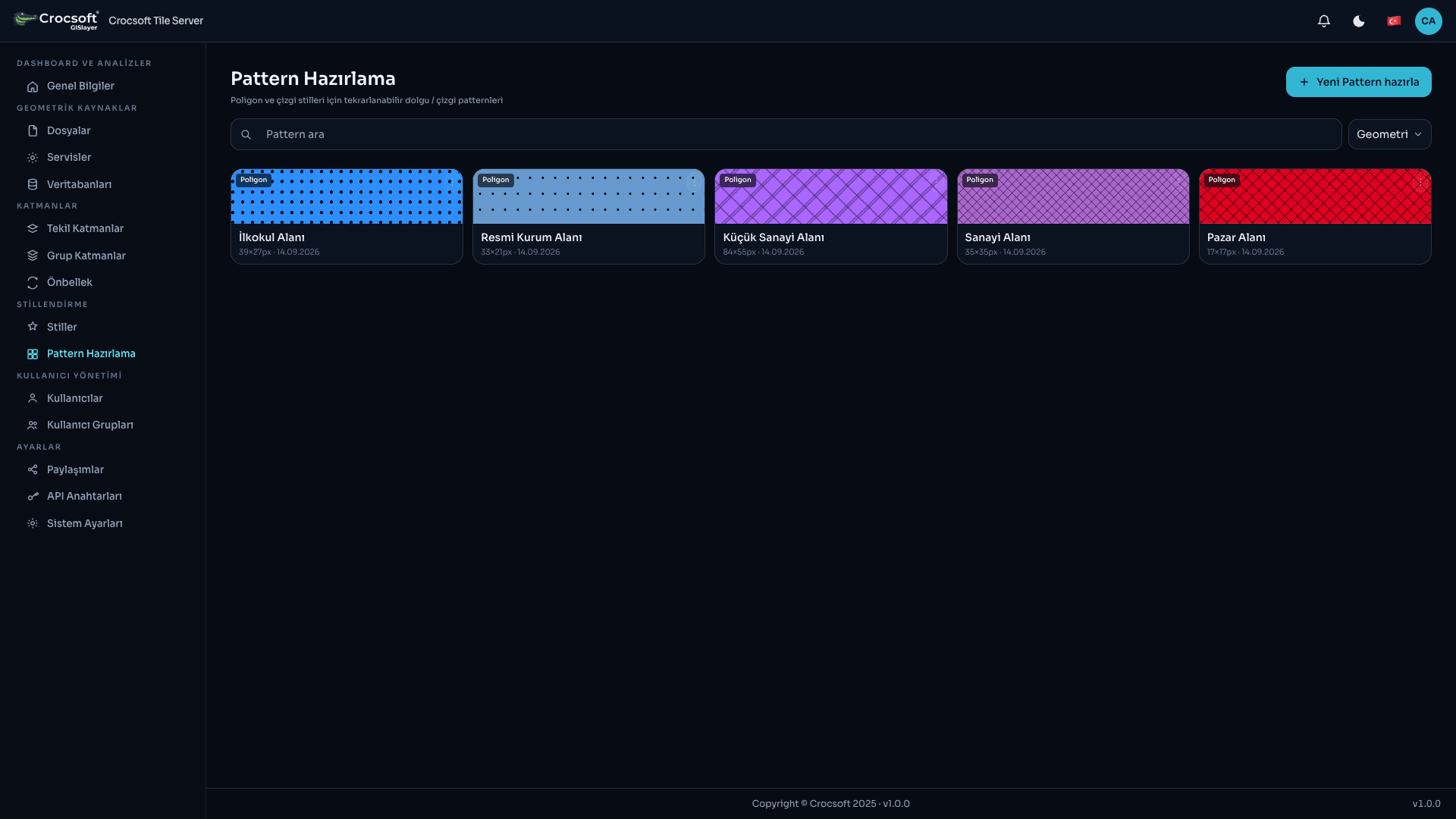 Preparing styles with hatching and patterns
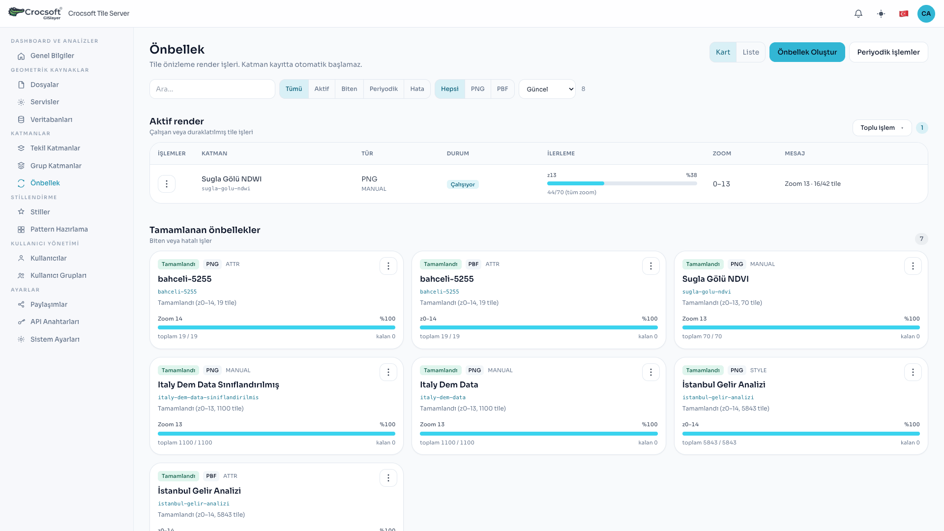 Configuring caching operations
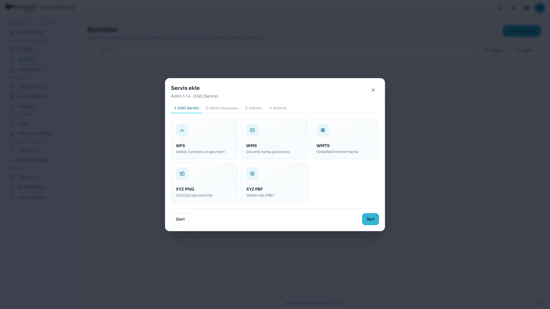 Adding GeoServer and MapServer OGC services
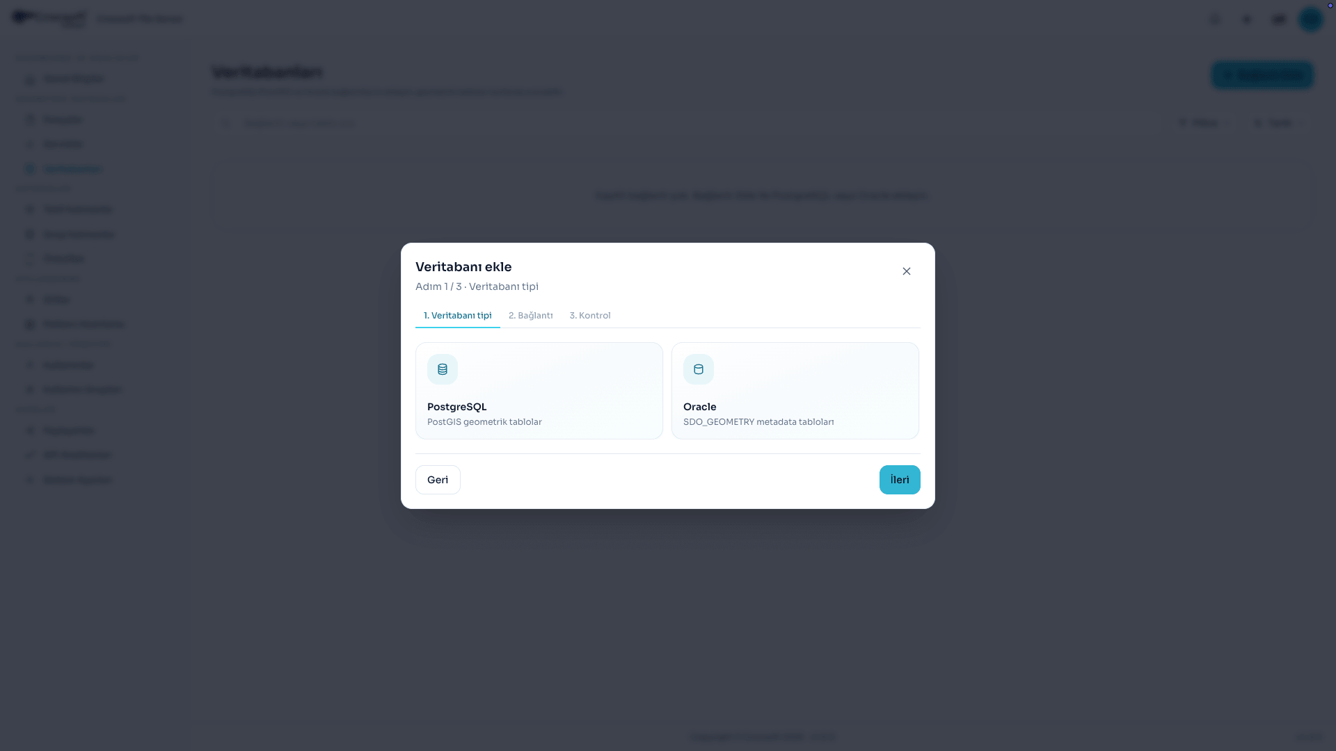 Connecting PostgreSQL and Oracle databases
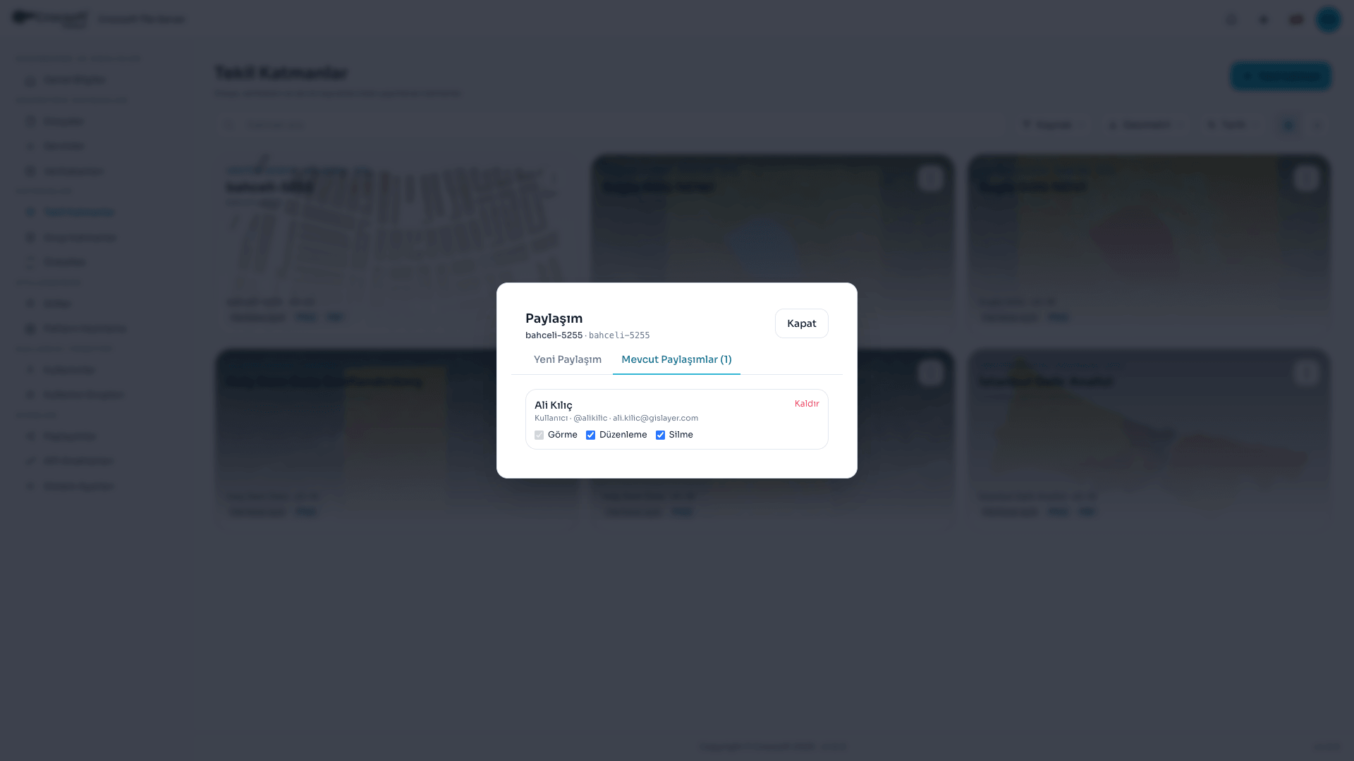 Sharing layers with users
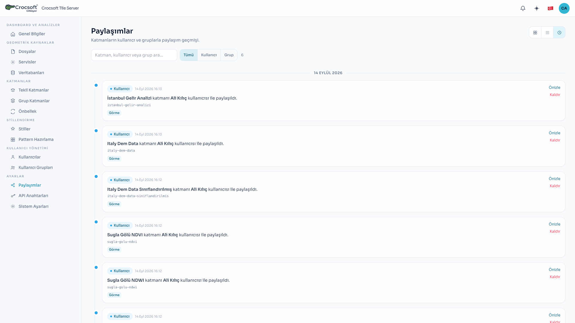 Managing users who have been granted shares
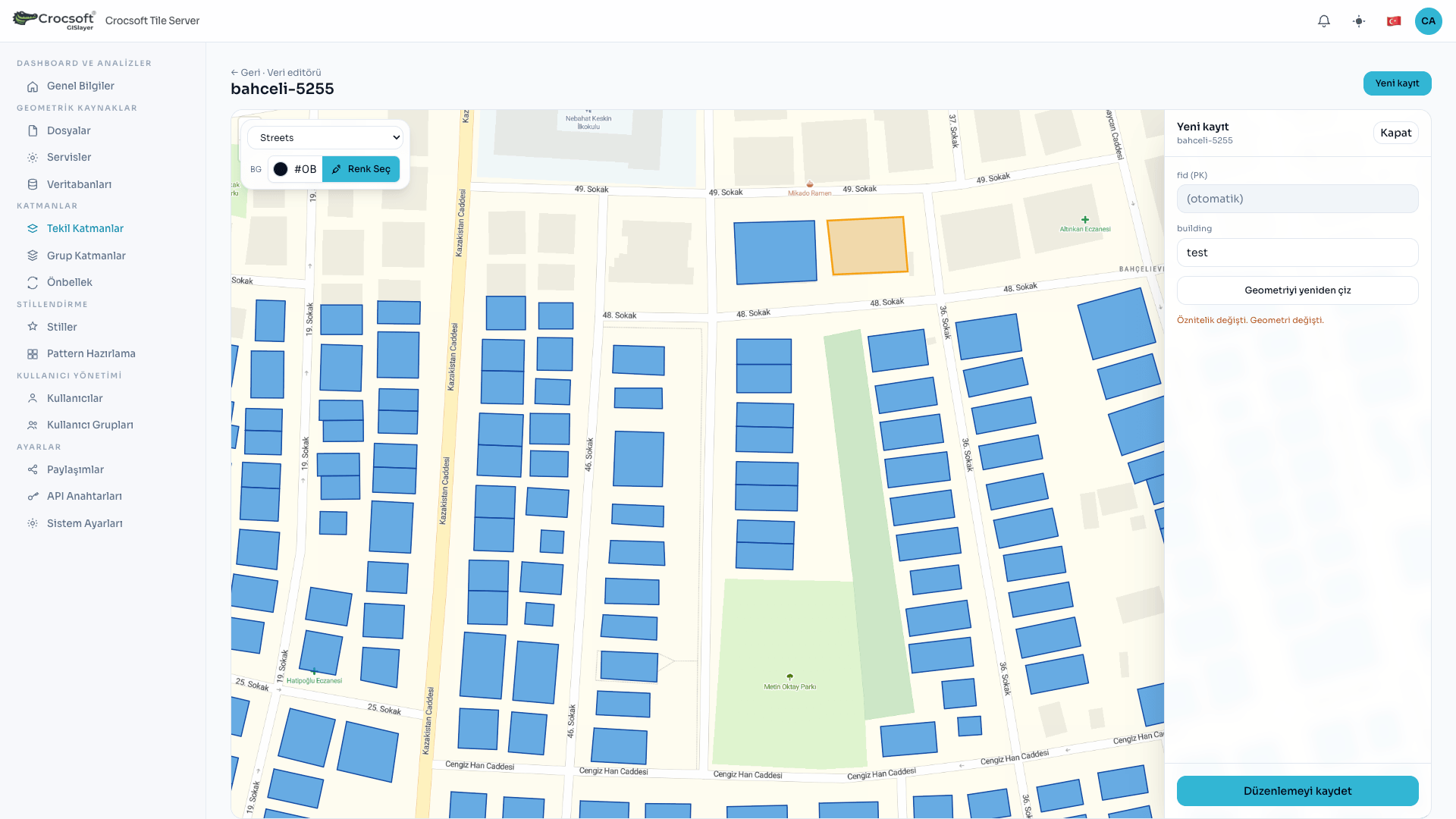 Editing layers in the GIS editor
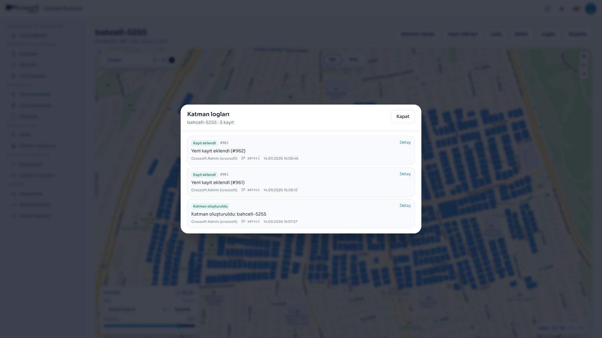 Listing layer changes and logs
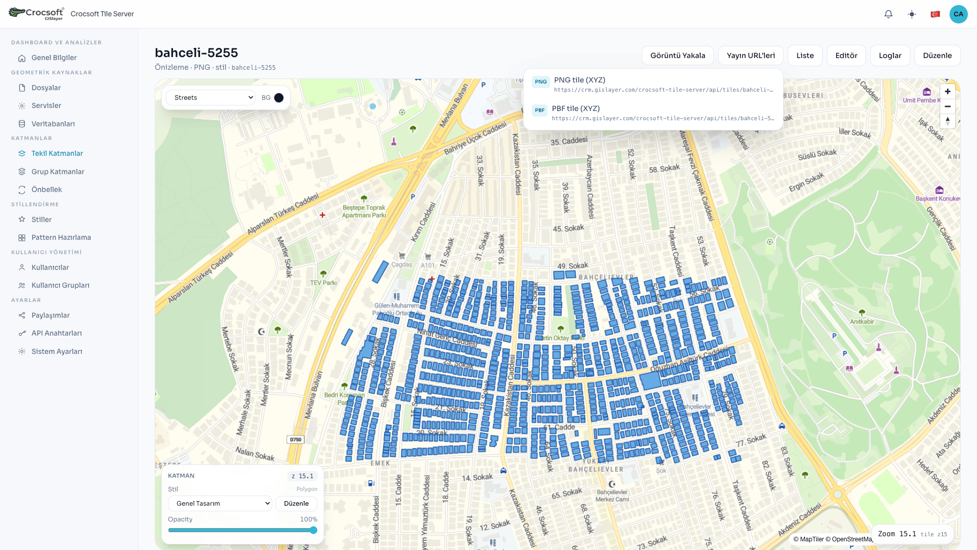 Copying XYZ PNG and PBF tile service URLs for layers
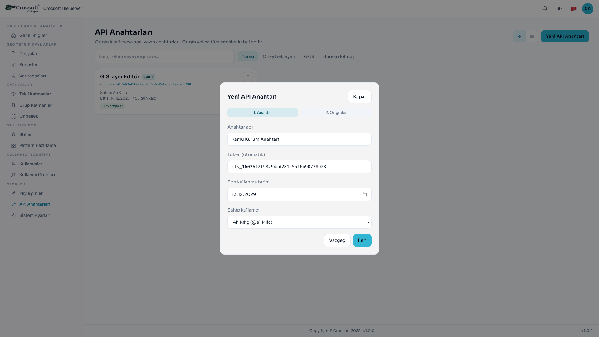 Setting API key usage and permissions for users
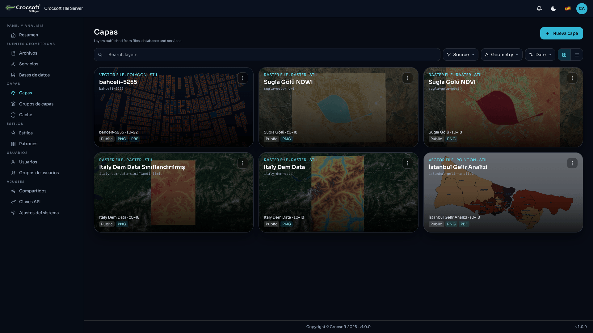 Using the system in other languages
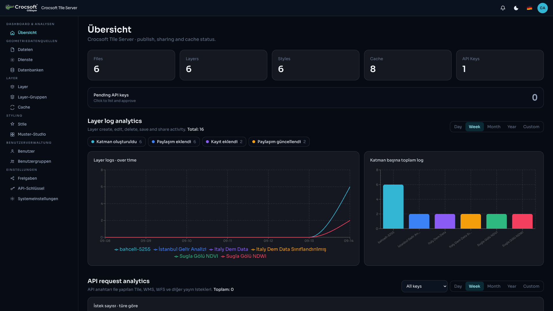 Showing API requests and layer edit logs on the dashboard
Crocsoft Tile Server
Keep your data under your control
For organizations, map data is not just a “visual layer.” Boundaries, ownership, infrastructure, agriculture, environment, disaster, defence, and planning information often sit behind a single server. When that server is misconfigured, left unpatched, or exposed too widely to the internet, the risk is not only a broken web page: it is data leakage, tampering, or loss.
Crocsoft Tile Server is map server software designed so organizations can manage, publish, and share geographic data in a secure, controlled, and high-performance way. Whether or not you already run GeoServer or MapServer, this product is a complete map server on its own. It also lets you connect existing services and control outward exposure through a single secure gateway.
Why many organizations are still at risk
GeoServer and MapServer have been widely used for years and offer strong capabilities. Widespread use, however, is not the same as security. Especially in environments that were “installed once and never touched,” these problems appear often:
- Panels and service endpoints too open to the internet — When admin UIs or WMS/WFS endpoints have weak authentication, data becomes available not only to “appear on a map” but also to be bulk-downloaded or abused.
- Unpatched installations — Classic map servers need security updates over time. The longer updates are delayed, the more known vulnerabilities become ready doors for attackers.
- Public or loose access — The habit of “everyone inside can see it” can turn into external access through leaked links, screenshots, and API calls.
- No clarity on who used or downloaded what — Structures that leave no trail when data leaves make it hard to answer “what did we lose?” after a leak.
- Trading security for performance — When heavy tile traffic slows the system, some organizations open access even further and grow the risk.
In short: producing data is not enough. You also need to manage who sees it, how it is published, and that it does not disappear. Crocsoft Tile Server addresses exactly that need.
What this software delivers
1) Enough even if you have no map server yet
Crocsoft Tile Server is a map server product in its own right. You upload files, turn them into layers, apply styles, build cache, and get secure publish links. A separate GeoServer / MapServer install is not required. For your organization, the “set up a map server” project is this product.
2) You can still use existing GeoServer / MapServer / XYZ services
If you already have a working map stack, you do not have to throw it away. The software lets you connect existing WMS, WMTS, WFS, and similar services as sources. That way:
- You protect past investments,
- You centralize new publishing and access control through Crocsoft Tile Server,
- You can lock the door to the outside world from one place.
So you manage both consumer (using existing services) and producer (running your own secure publish) roles from the same panel.
3) Security is not an “extra”—it is part of the design
These principles sit at the centre of the software for enterprise data security:
- User login and role / permission management — Who sees what, who adds, who deletes, who shares is clearly defined.
- Layer- and file-based sharing — Data belongs to its owner by default; others do not see it until it is shared.
- Public / private publish split — Public layers open under control; private layers require an API key for external clients.
- API keys and origin limits — Allowed origins can be set per key; leave empty for flexibility, fill in for strict control.
- No information leak on unauthorized access — Unauthorized requests are not told “this layer exists but you cannot see it”; denial is handled carefully.
- Password policy and account management — The enterprise user lifecycle is managed from the panel.
- Backup / restore — Backup for the database, settings, styles, and critical content; reduces loss in a disaster.
The goal is clear: Your data should not be lost, stolen, or sent to the wrong person.
4) Performance is part of publish quality
Map users do not tolerate slow tiles. The software aims for a smoother experience in both the internal panel and external publishes with:
- Layer-based cache generation,
- Prebuilt tiles by zoom range,
- Cache progress tracking,
- Architecture that reduces recomputation under heavy load.
Security and performance are not alternatives; they are planned together.
Why consider this software if you do not want to lose data?
- Single-pane control — Files, databases, services, styles, layers, cache, and API keys share one management model.
- Fewer orphaned datasets — Every file and layer has an owner; sharing is recorded.
- Opening to the outside ≠ giving up security — Private publish, API keys, and origin rules enable controlled sharing.
- Stop treating legacy systems as an open door — Instead of putting GeoServer / MapServer directly on the internet, use Crocsoft Tile Server as a secure storefront and gateway.
- Backup and continuity — Runs as a durable service; settings and data directories are preserved across updates.
- Enterprise presence — Multilingual UI, brand / server name, public URL, and context path fit institutional environments.
Once data leaves, bringing it back is often impossible. So the right question is not “How do we publish the map?” but “How do we publish without losing the data?”
Feature tour (detailed)
Below is a functional summary of the main capabilities Crocsoft Tile Server offers users.
1. Overview and analytics panel
- Enterprise summary: file, layer, style, cache, and API key status
- Time-based view of layer operation logs
- API request analytics (by layer, key, and owner)
- Day / week / month / year and custom date-range filters
- Fast tracking of API keys awaiting approval
This panel goes beyond “is the system up?” and also answers who is using how much.
2. File management (geometric sources)
Supported type families:
- Vector: GeoJSON, KML, KMZ, SHP (ZIP), GPKG, DXF, NCZ, and more
- Raster: GeoTIFF / TIF, PNG, JPEG, GIF, WebP; optional georeference sidecars
- 3D model: GLB, GLTF, OBJ
Highlighted capabilities:
- Wizard-based upload and editing
- Coordinate system (EPSG) selection; for projected data, conversion to a standard geographic system and BBOX update on save
- Raster georeferencing (corners or control points)
- Remote sensing settings on multiband rasters (sensor templates, band mapping, RGB / index prep)
- Preview, map display, 3D model placement
- File cards, search, geometry and size filters
3. External service connections
- Registering GeoServer, MapServer, and XYZ-like sources in the system
- Capability / probe-based service discovery
- Using those services as sources when building layers
So the organization can move to a new security and management layer without suddenly shutting down existing publishes.
4. Database connections
- Building layers from enterprise database tables / geometry
- Connection test and management screen
- Field, primary key, and published attribute selection when creating a layer
5. Single layers
- Create layers from files, databases, services, or 3D models
- Layer key, zoom range, visibility, and publish types
- Style assignment and preview
- Sharing (user / group) and permission flags
- Publish URLs: PNG tile, PBF (vector tile), WMS, WMTS, WFS, 3D tileset (by source)
- Card / table views, search and filters
- Layer logs and handoff to cache generation
Public / private split: Private layers do not rely on a session alone outside; they expect controlled access via API key. Inside the admin panel, authorized users keep working.
6. Group layers
- Combine multiple layers under one group
- Order, member zoom ranges, and group preview
- Publish and cache scenarios through the group
7. Style management and pattern studio
- Vector and raster styles
- Zoom-aware style definitions
- Colour or pattern for fill / stroke
- Pattern studio (repeatable fill and line patterns)
- Raster indices and classified / linear displays (e.g. NDVI-like analysis styles)
- Style preview and card imagery
8. Layer editor
Authorized users (owner, system admin, or those granted permission via sharing):
- Attribute editing
- Geometry correction / adding new records
- Select, draw, and edit flow on the map
- Refresh of cache tiles in the affected region after save
- Edit permission checked both in the UI and on the server
So the ecosystem is not “publish only”—controlled data updates stay in the same place.
9. Cache management
- Cache jobs by layer or region (BBOX)
- Zoom ranges, progress, pause / resume / cancel
- Re-render and periodic refresh
- Controlled response behaviour for missing-tile cases when cache is on
Cache speeds up the user experience and reduces load on the source server.
10. Users, groups, and shares
- User creation, role assignment, profile and password management
- User groups
- Choosing view, edit, delete, and similar permissions on layer / resource shares
- Share lists and removal
Data is not managed like an “open-to-everyone folder”; it is managed as an asset with a clear owner and permissions.
11. API keys
- Creating multiple keys
- Origin / source limits (empty = flexible, filled = strict match)
- Approval flows and usage analytics for traceability
This is the enterprise door for mobile apps, websites, or third-party integrations.
12. System settings and operations
- Server name, listen port, external public URL, context path
- Enterprise email (SMTP) settings
- Role wizard with a menu / module permission matrix
- Backup and restore
- Durable service install, start on boot, recover after failure
- Multilingual UI (Turkish, English, and other languages)
- Light / dark theme
13. Publish standards (the outward face)
Depending on layer type, the software produces the publish formats common map clients expect:
- Raster / PNG tile
- Vector tile (PBF)
- WMS / WMTS / WFS
- 3D tileset publishes
- Style JSON / TileJSON-like definitions
That lets you integrate with MapLibre, Cesium, similar clients, enterprise GIS products, or your own web apps—while you set the access rules.
Who is it for?
- Municipalities, public bodies, and regulators
- Energy, infrastructure, telecom, and transport teams
- Agriculture, forestry, environment, and remote sensing units
- Organizations with defence / security sensitivity that still need to share maps
- Teams on GeoServer or MapServer that want to make outward exposure safer
- Organizations with no map server yet that want storage and publishing in one product
Conclusion: Publishing a map is not the same as giving data away
Crocsoft Tile Server’s message is simple:
Manage without losing your data, share under control, and publish fast.
Keep using your existing map services; keep the outward door secure.
Even if you have no map server yet, this software already is your map server.
When enterprise geographic data leaks or is corrupted once, recovery costs far more than a software investment. That is why Crocsoft Tile Server is not only a “tile producer,” but an enterprise map server platform designed for data ownership, access control, performance, and continuity.
Crocsoft Tile Server — secure publish, controlled sharing, enterprise performance.


Don't hesitate to contact us
At our IT solution company, we are committed to exceptional service and support for your business needs.
Get in Touch