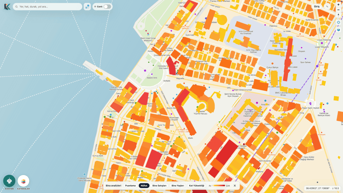
 Analyze buildings by population with AI
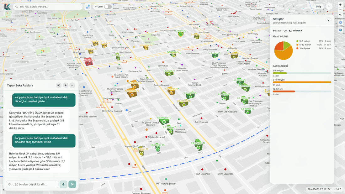 Query home sale information
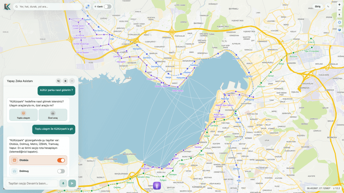 Build a smart route with public transport
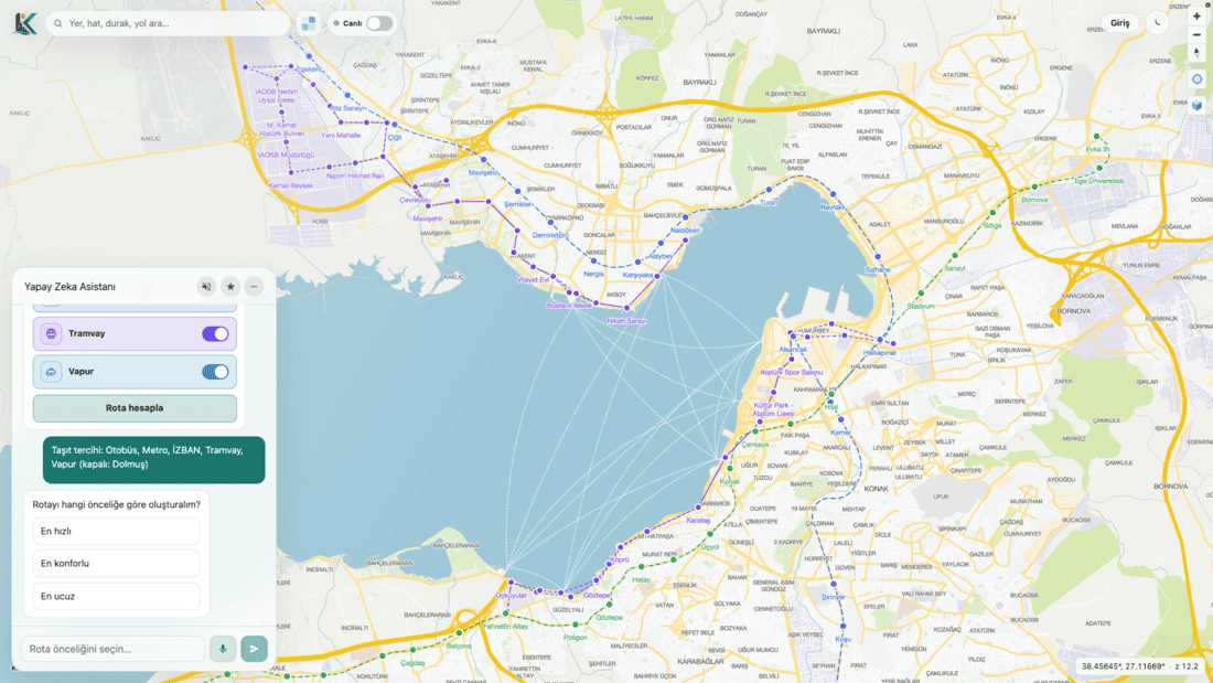 Comfort, fast travel, or cheap travel—your choice
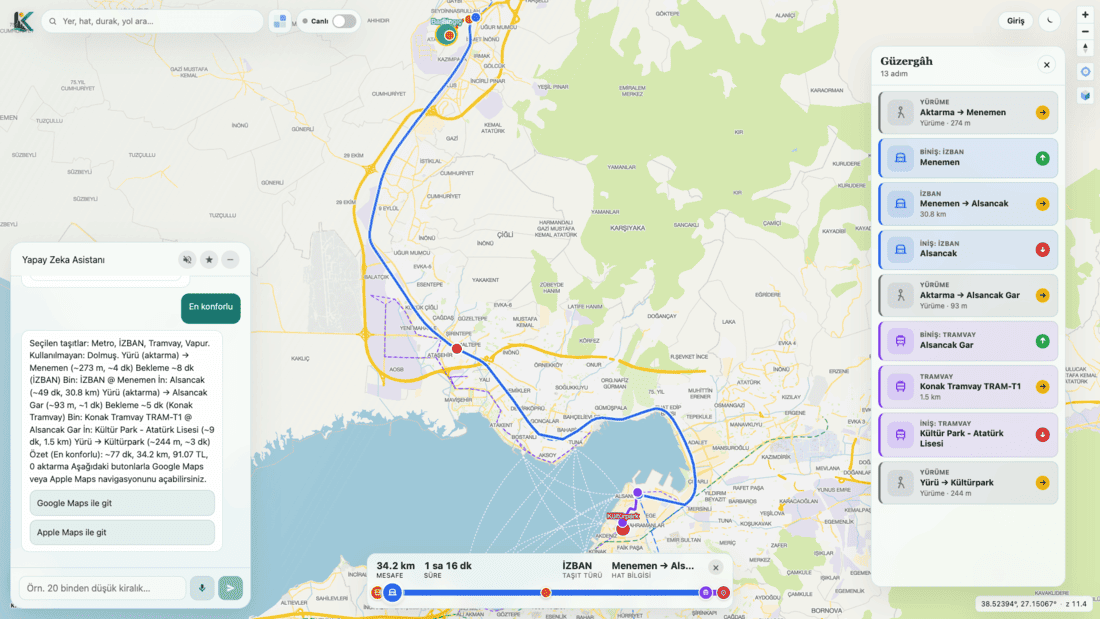 See step by step how to reach public transport
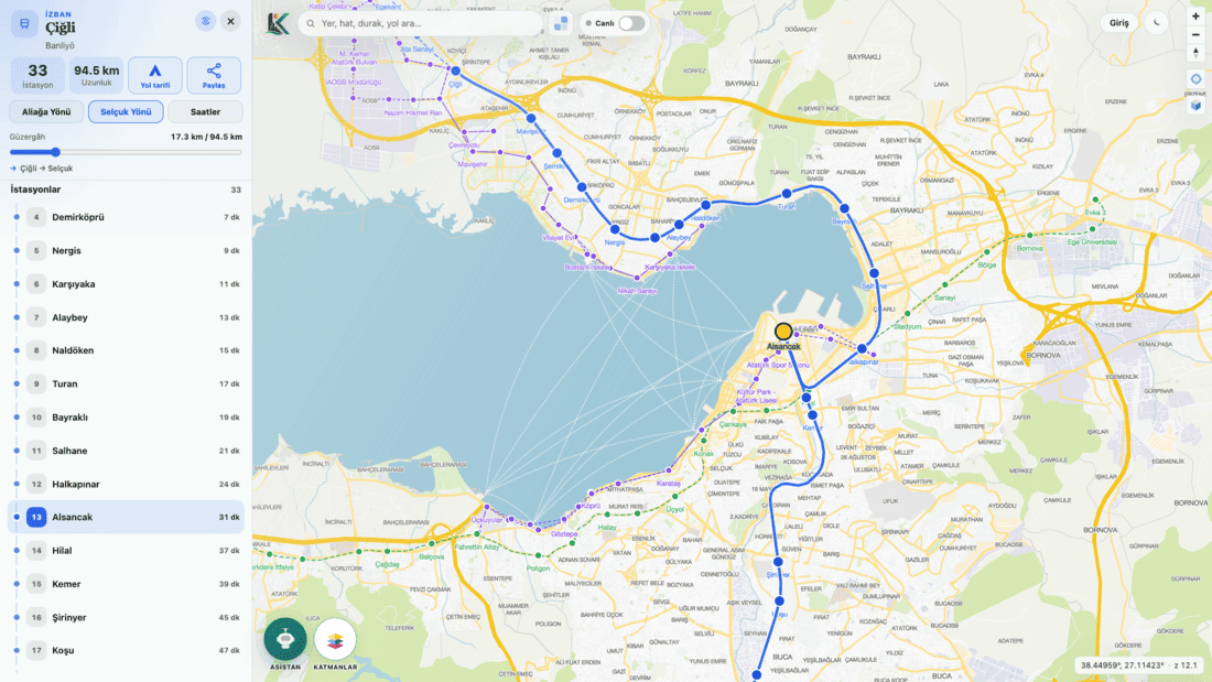 Check train and metro times and routes
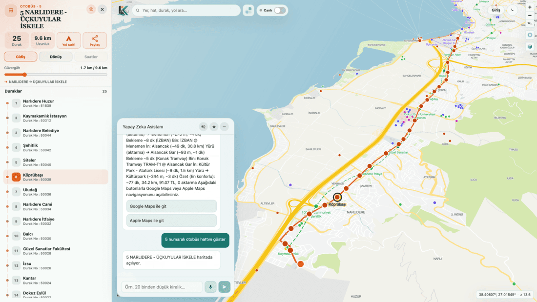 Check bus stops and routes
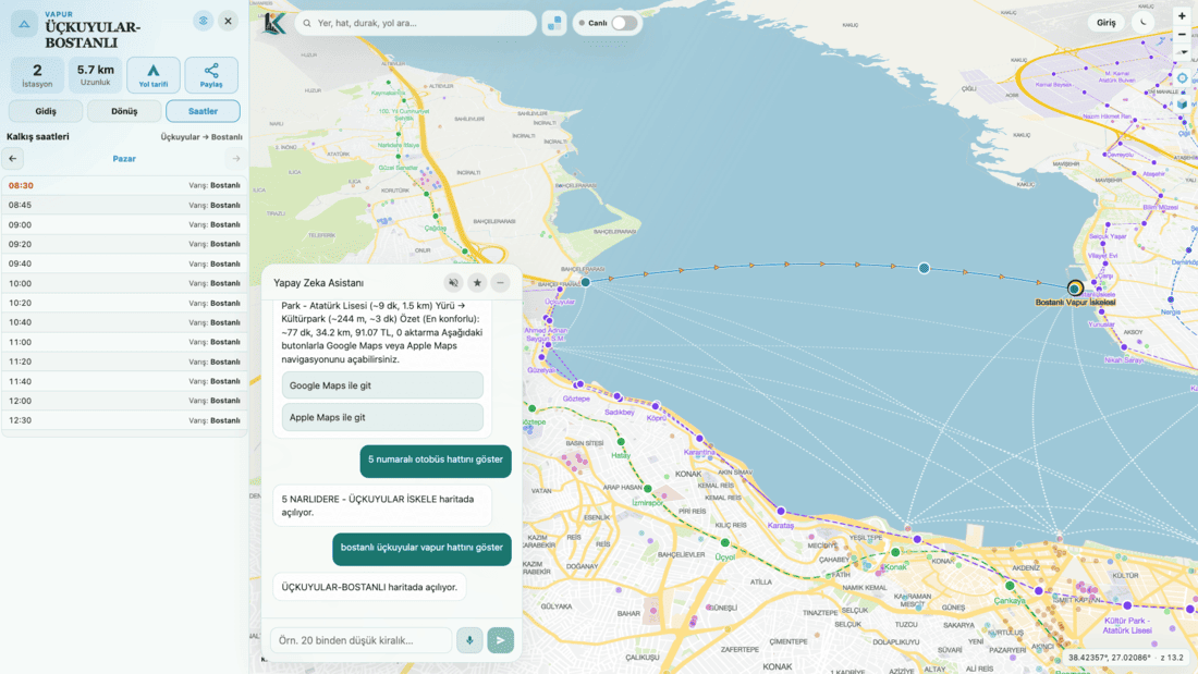 Check ferry times and routes
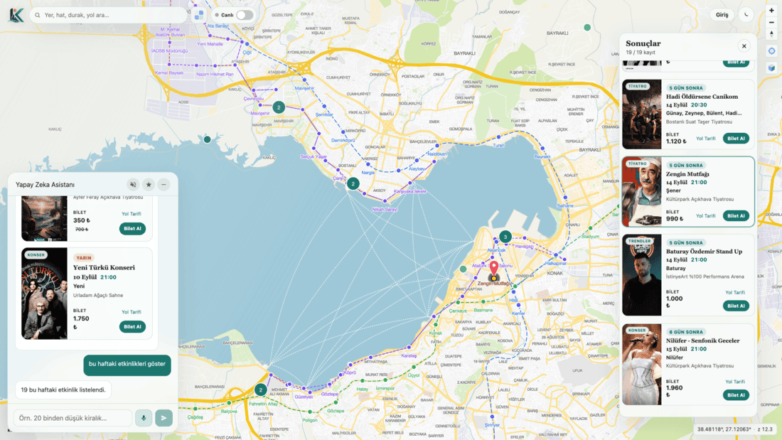 See concerts, theatre, and events in your city
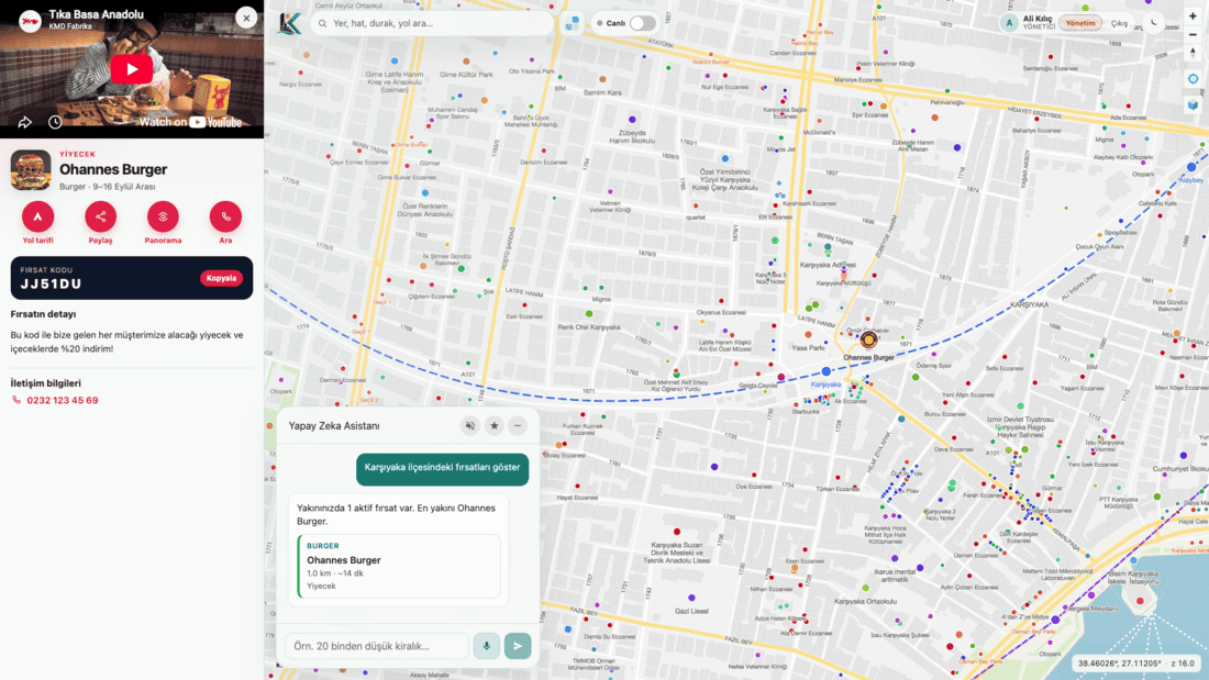 Do not miss discounts in your city
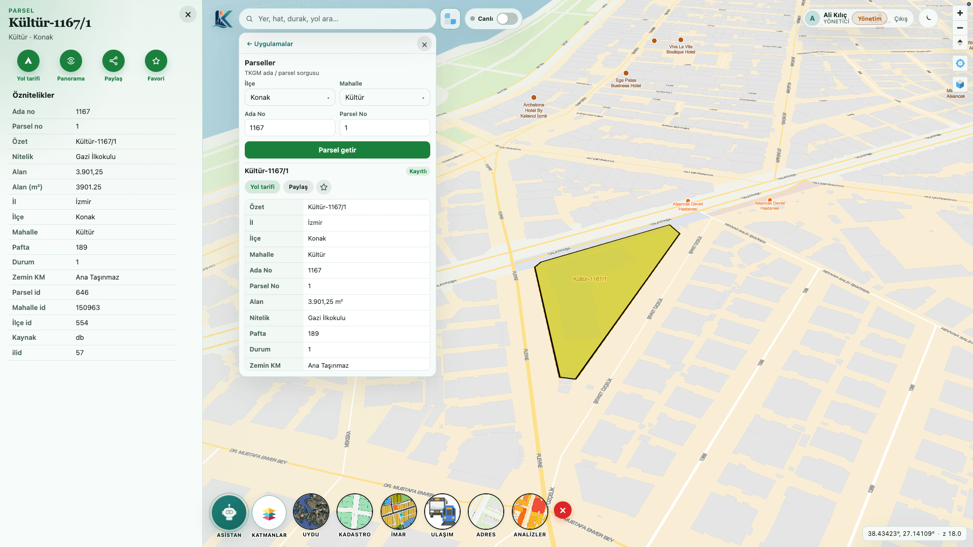 Reach your parcel information with AI
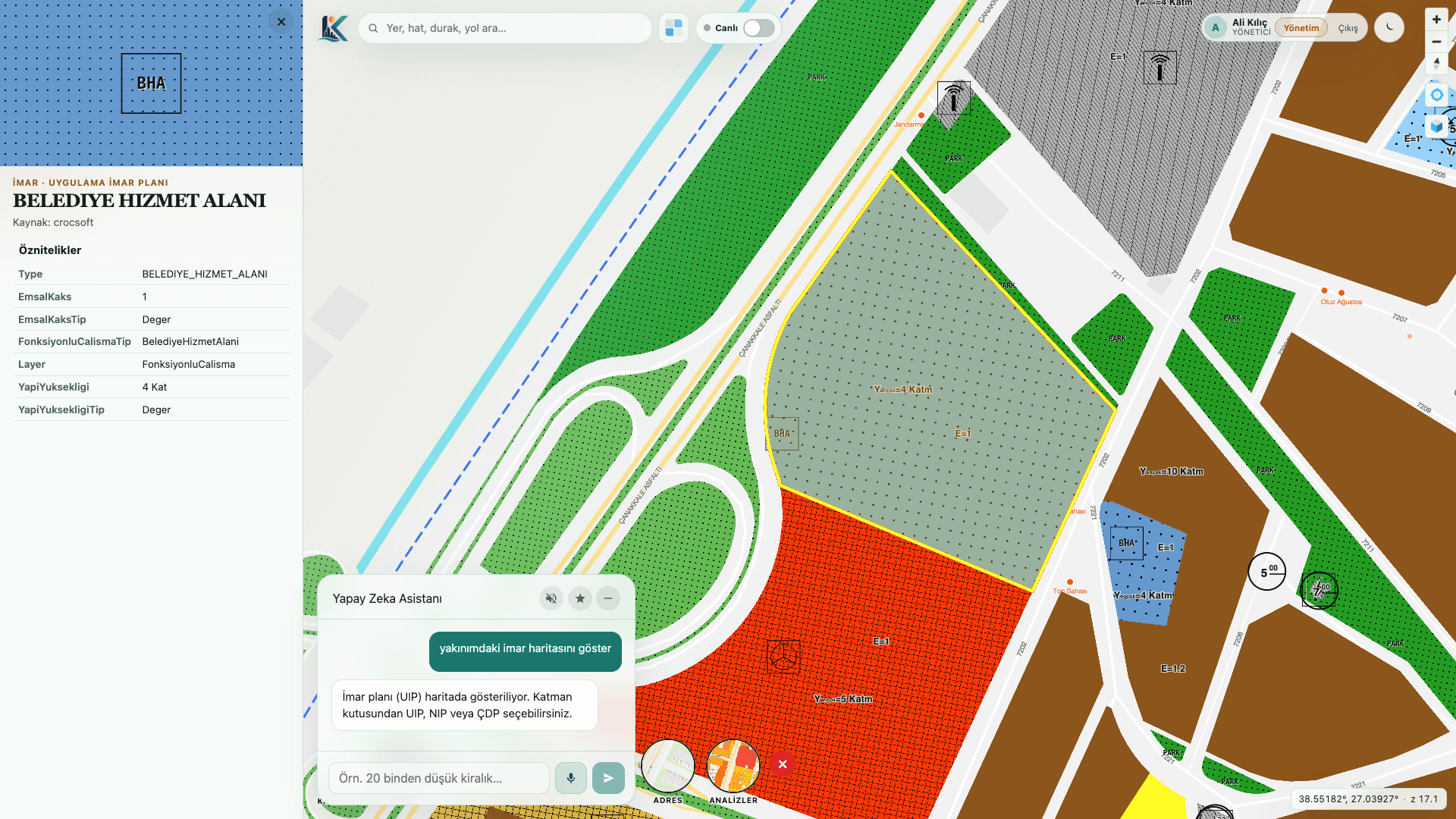 Query your zoning maps with AI
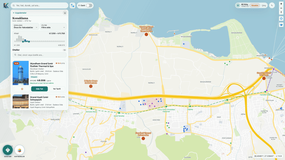 Show tourists the most suitable hotels
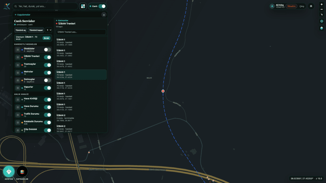 Watch AI-powered live data day or night
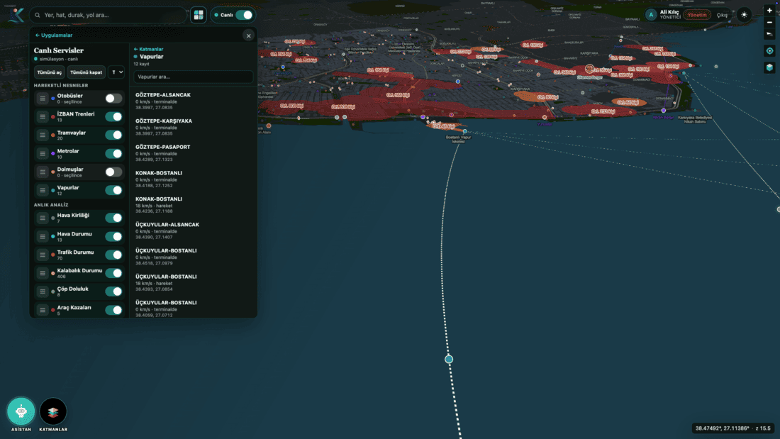 Track buses, trains, metro, and trams in real time
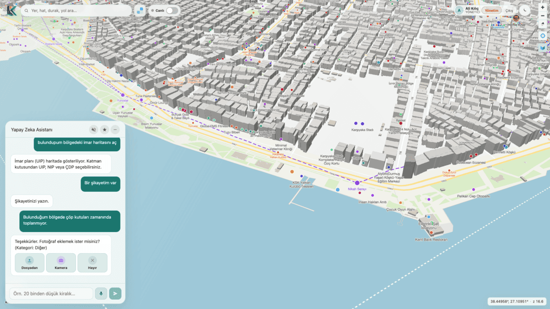 Submit your complaints
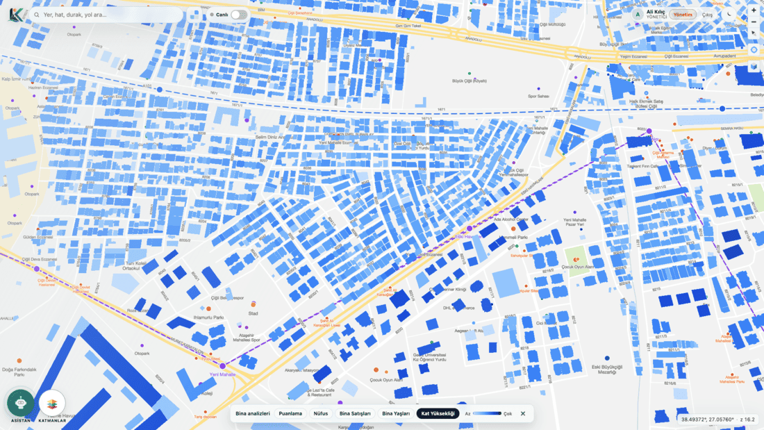 Analyze building and home age, population, and sale prices
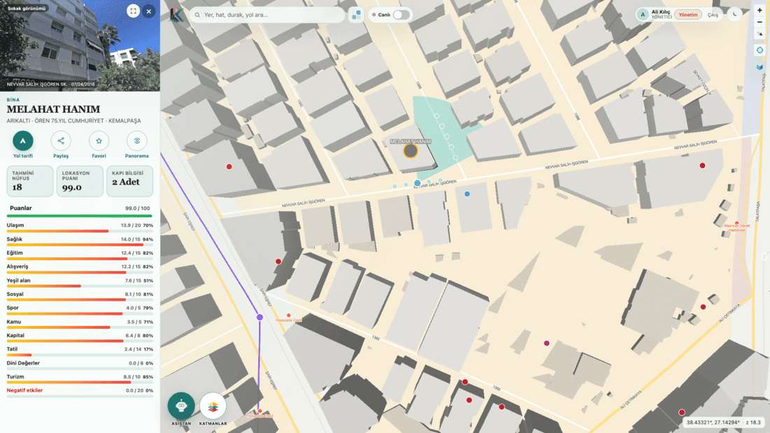 See buildings on street maps and reach POI scores
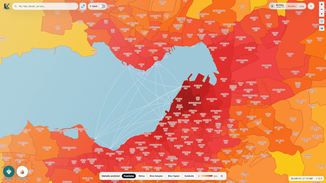 Analyze population and average building age by district and neighbourhood
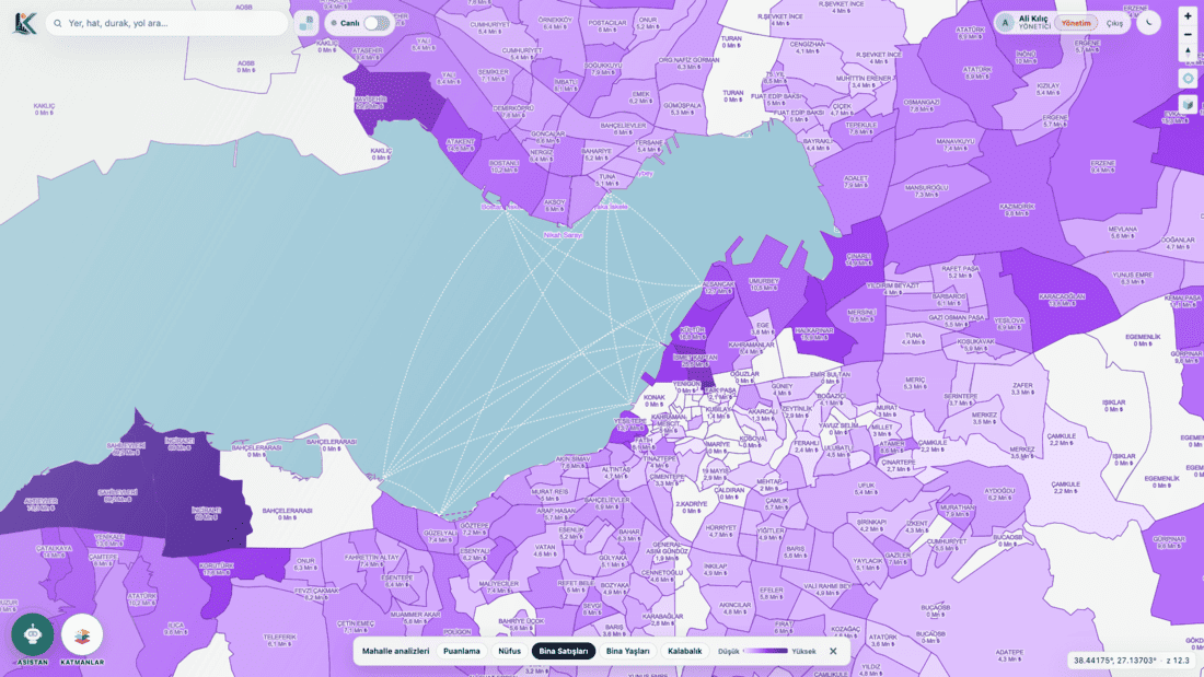 Analyze average building sales by district and neighbourhood
Vector sources: Prepared using OSM, Here, and Yandex.
Citizens now ask AI first. Your municipality’s guide should speak that language too.
AI-Powered City Guide is a web and mobile city guide built by Crocsoft for municipalities. Citizens ask in writing or speech; the system understands intent, finds official urban data, shows the result on the map, and can narrate it in spoken Turkish.
This is not just a map app. It is how the municipality talks to the citizen.
Overview and Expertise
AI-Powered City Guide is designed to meet the following core needs:
- Natural-language assistant: Written and spoken questions; intent understanding; spoken Turkish answers.
- Map marking: Answers end as layers, points, and routes on the map.
- Nearest POI: Closest point by category (e.g. on-duty pharmacy).
- Address and location: Door number, neighbourhood, street; “what is this place?” ends on the map.
- Public transport: Lines, stops, stations, departure times, and transfer routes.
- Parcel and zoning: Find block–parcel; show zoning status for the area of interest.
- Buildings and neighbourhoods: Average housing prices; building valuation by distance to key points.
- Events, offers, lodging: Social events, discounts, hotel-room help for visitors.
- Live city: Instant location analysis; traffic and crowd rates.
- Complaint records: Potholes, broken lamps, full containers, illegal parking—with location, photo, or video.
- Favourites and navigation: Save favourite places and get directions.
- Accessibility: Listen and receive spoken answers for visually impaired users.
- Admin panel: Layers, points, complaints, events, and content managed by municipal teams.
This structure replaces scattered menus, PDFs, and separate sites with one channel, one identity, a city you can talk to 24/7.
What Does the AI-Powered City Guide Do?
The AI-powered city guide lets citizens talk to their city naturally from the web or a mobile device, in writing or by voice. It does not expect special training or technical knowledge from the user.
Its main capabilities are:
- Finds the nearest important point by category (for example an on-duty pharmacy).
- Explains step by step how to reach an address by public transport.
- Shows the nearest public-transport stops and stations on the map.
- Provides information about public-transport departure times.
- Helps you save favourite places and navigate to them easily.
- Finds the parcel you are looking for and shows it on the map.
- Gives up-to-date information on the zoning status of the area you are interested in.
- Lets you discover social events taking place in your city.
- Lists average housing prices at district and neighbourhood level.
- Analyses and scores the building you are curious about by its distance to key points.
- Guides tourists in your city through hotel-room booking.
- Offers live city analysis using real-time location data.
- Visualises traffic density and crowd levels on the map.
- Lists current discounts and economic opportunities in your city.
- Improves accessibility with spoken listening and answering support for visually impaired users.
Its most important feature is that it is a system that learns as citizens ask questions and continuously improves itself.
Technology and Tools
The platform is built as a web and mobile stack. Key components:
- AI assistant: speech-to-text, intent understanding, routing to the right urban service
- Multi-channel answers as text + map + voice
- 2D and 3D maps; stacked zoning, building, neighbourhood, and live layers
- Official urban layers: address, transport, pharmacy, parcel, zoning, events, complaints
- Web + mobile with the same identity, data, and language
- Admin panel for municipal teams
- Live camera, air quality, and crowd services
It can extend to the municipality’s existing GIS, transport, cadastral/zoning, and complaint systems. Google Maps shows the world; it does not run your city. On-duty pharmacies, zoning legends, parcels, complaint categories, and ferry times are municipal work.
Process and Approach
A typical workflow:
- Ask: The citizen writes or speaks on web or phone. No user training required.
- Understand: The system converts speech to text, understands intent, and connects the right urban service.
- Data: Official address, transport, zoning, pharmacy, event, or complaint data is found.
- Answer: The result is delivered as text, a map mark, and optional spoken narration.
- Act: Favourites, navigation, a complaint, or an admin-panel update when needed.
- Learn: The system improves as people keep asking.
There is no software to learn; there is a city to talk to.
Applications and Use Cases
The platform delivers value in urban scenarios such as:
- Daily citizen questions: Nearest on-duty pharmacy, bus time, directions, “what is this place?”.
- Zoning and title advice: Block–parcel and zoning status; official answers without queues.
- Trip planning: Stops, stations, departures, and transfer routes.
- Complaints and maintenance: Geolocated, categorised, media-rich records; faster unit assignment.
- Visitors and tourists: Questions in English, lodging, events, staying on the official guide.
- Local economy: Offers, events, neighbourhood and building readings.
- Accessible service: Older people, tourists, or visually impaired users proceed without memorising menus.
A classic city guide is a pile of menus. Here the citizen does not have to learn the app; they ask and get an answer.
Customization and Flexibility
- Urban services: Municipal layers (zoning, transport, pharmacy, complaints, cameras) can be toggled.
- Language and voice: Spoken Turkish answers; multilingual questions for visitors.
- Map view: 2D/3D, legend, live layers, POI categories.
- Complaint vocabulary: Institution-specific types, units, and media rules.
- Admin rights: Role-based management of layers, points, events, and content.
- Pilot area: Municipalities can show their own live data; we plan a city-specific presentation.
The product closes the gap: data stays with the municipality; the experience reaches the citizen’s pocket.
Support and Maintenance
To keep the solution reliable and current:
- Version and bug updates in a planned patch cycle.
- Content and layer training so municipal teams adopt the panel quickly.
- When needed, second-level support, GIS / transport / complaint integrations, and customization channels.
Pricing Types
Institution-based proposals are recommended by user count, service scope (transport, zoning, complaints, live city), integration depth, and support level. Example packaging:
- Source Code Delivery: Code installed on the institution’s server under non-redistribution terms; data stays on premises.
- Software as a Service: Web, mobile, and assistant hosted on Crocsoft infrastructure under an annual license.
Contact our sales team for detailed pricing.
Collaboration and Contact
In projects we aim for the right scope and realistic dates through:
- Regular status sharing and clear acceptance criteria,
- Close work with institutional process owners (zoning, transport, call centre, GIS, IT),
- Pre-release pilot area and citizen feedback.
Crocsoft prepares a live demo with the municipality’s own data. The demo shows written and spoken assistant, map, transport, zoning–parcel, pharmacy, complaints, and the admin panel.
Compliance and Standards
System design is grounded in:
- Official urban data (address, parcel, zoning, transport, complaints) in one channel,
- Traceable complaint records with location, media, and category,
- Accessibility via spoken question / spoken answer,
- Data ownership remaining with the municipality
(final compliance reporting is produced per institutional requirements).
With AI-Powered City Guide, the municipality reduces call load, organises complaints, makes institutional data visible, and offers the conversation experience citizens already expect—on the official channel.
What you gain at a glance
- Forcing menu memorisation → Asking and getting an answer
- Scattered sites and PDFs → One channel, one identity, 24/7
- Call-centre repetition → Pharmacy, bus, address, and parcel questions handled by AI
- Locked GIS layers → Official data visible in the citizen’s language
- “Who do I write to?” → Geolocated, categorised, media-rich complaints
- Inaccessible interface → Spoken question, spoken answer, mark on the map
A city guide is no longer optional decoration. It is where citizens remember you every day. The most current city knowledge is in the municipality’s hands; that power should stay on your channel.
Meeting and demo: info@crocsoft.com


Don't hesitate to contact us
At our IT solution company, we are committed to exceptional service and support for your business needs.
Get in Touch