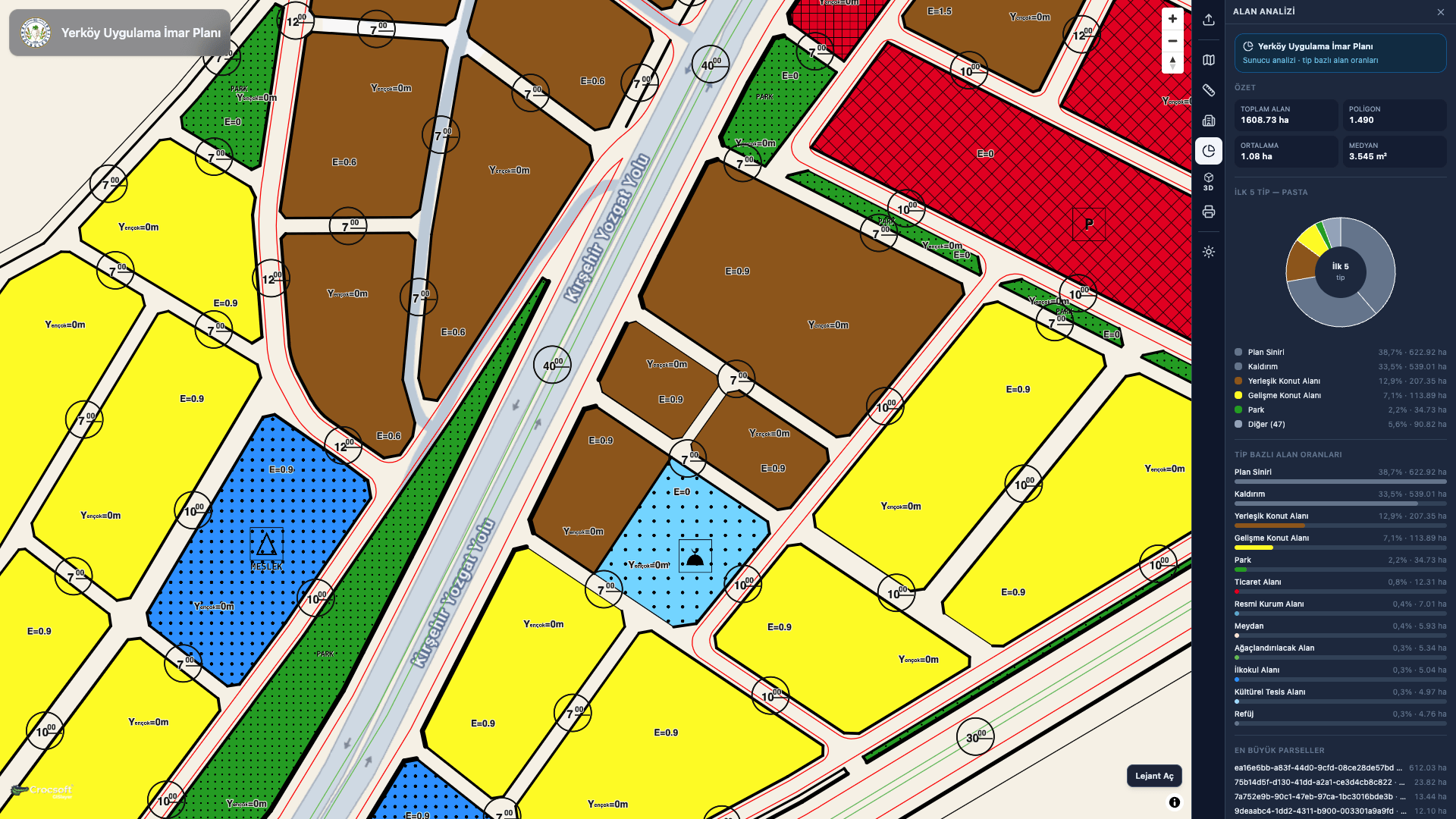
 Main map and plan workspace
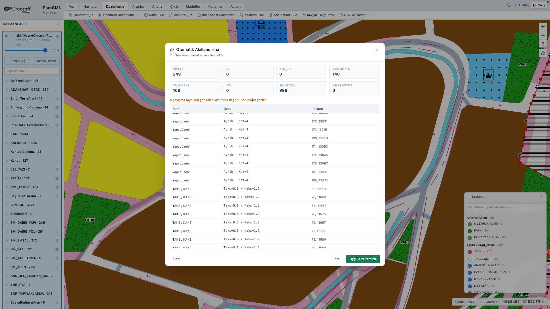 NCZ enrichment and PlanGML conversion
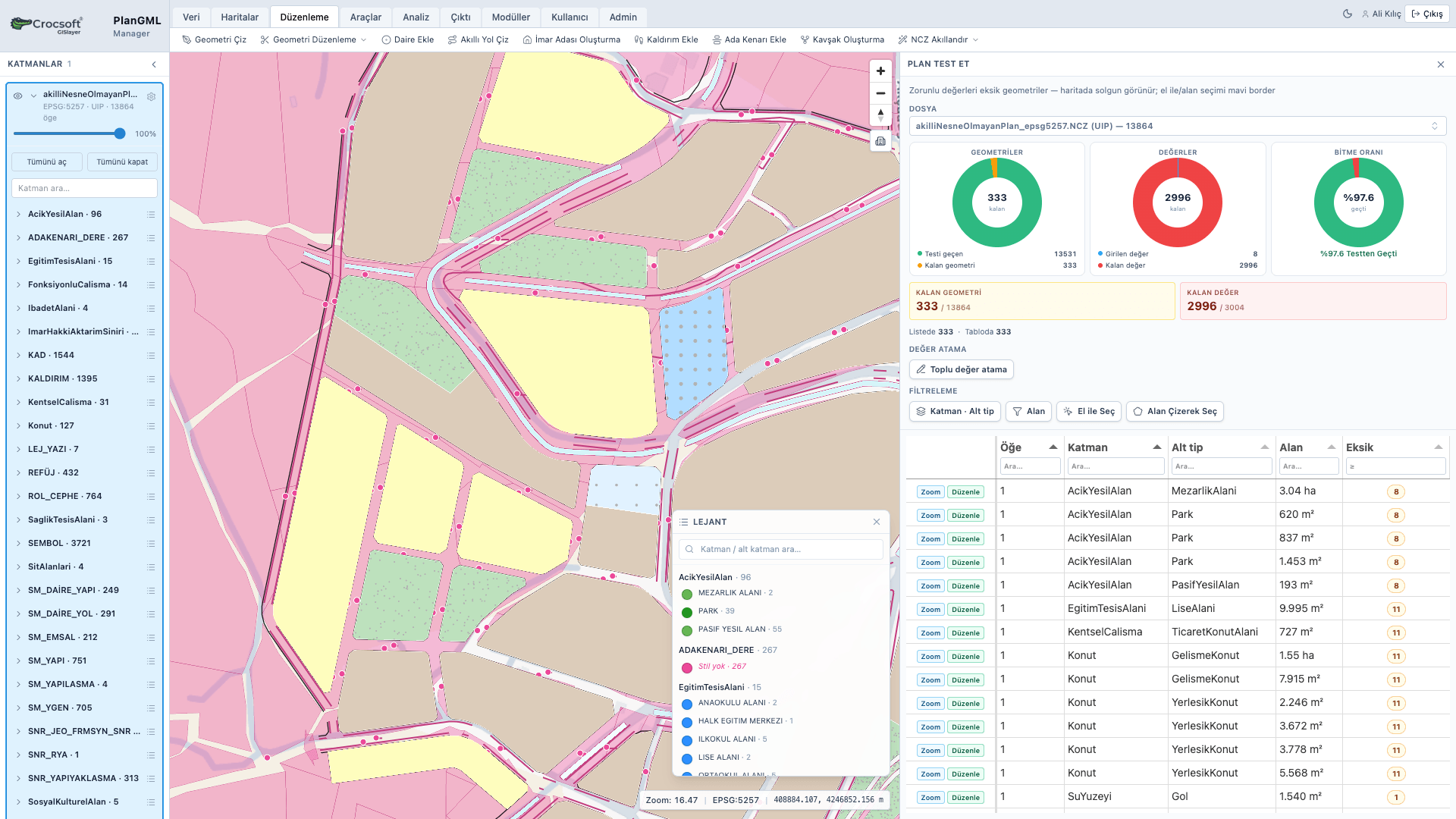 Quality control and error detection
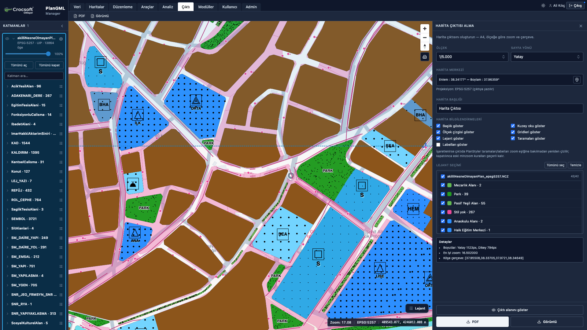 Scaled PDF and presentation output
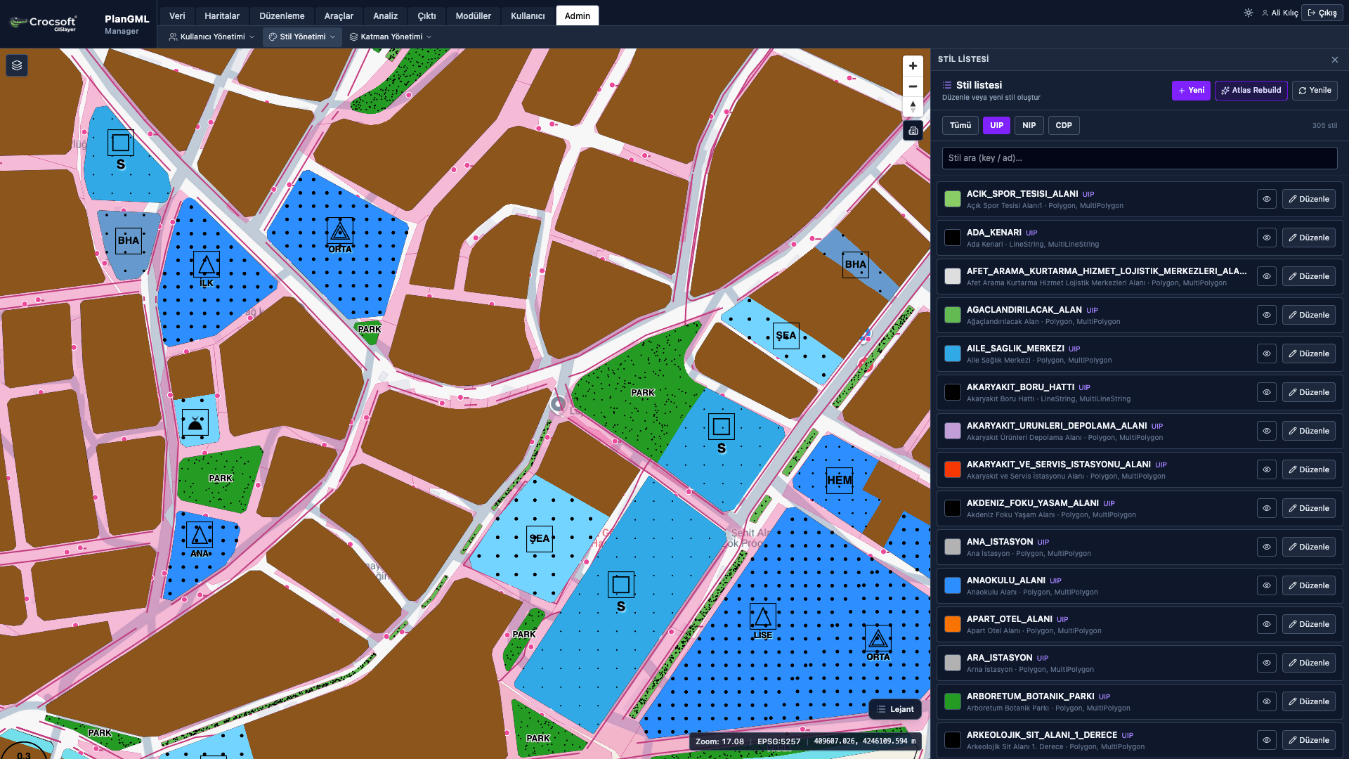 Central style and legend management
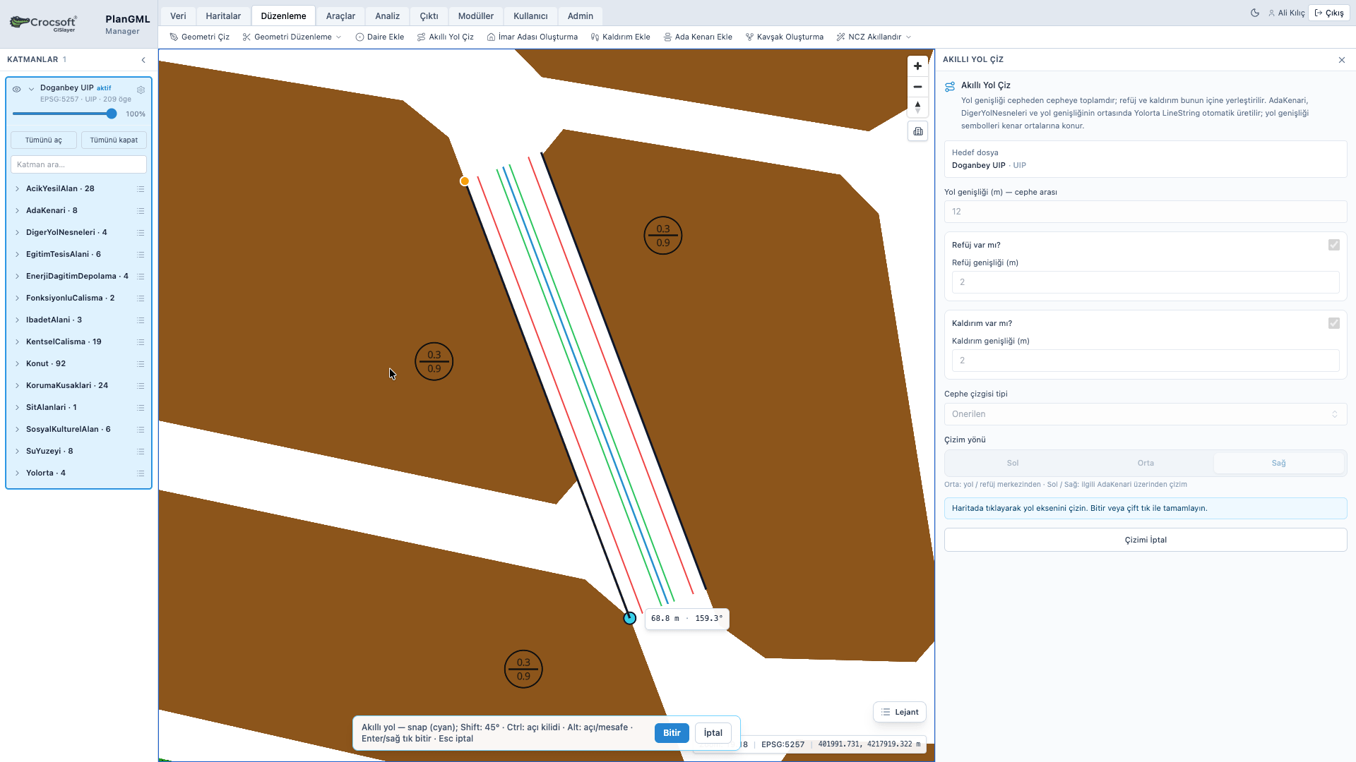 Road, block, and sidewalk drawing tools
 Bulk update and matching
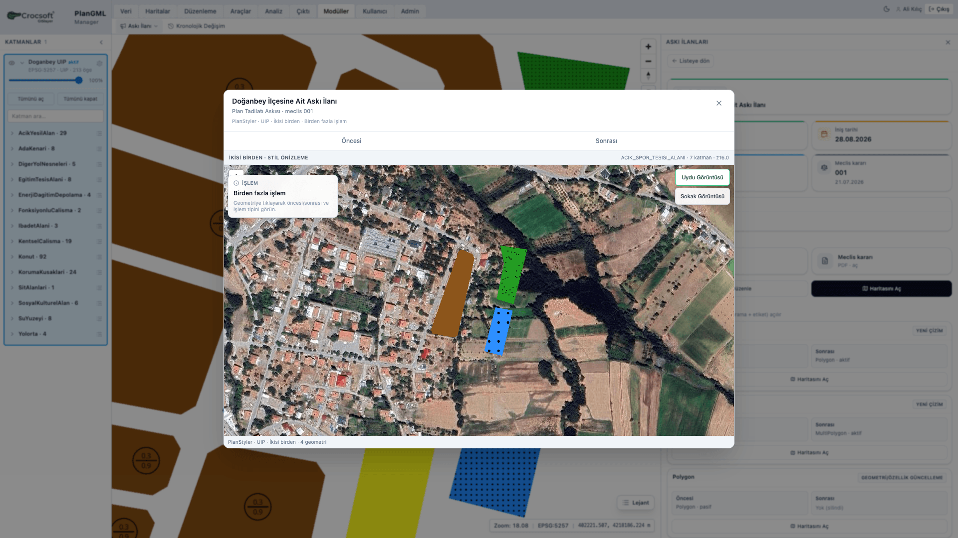 Public notice and publish page
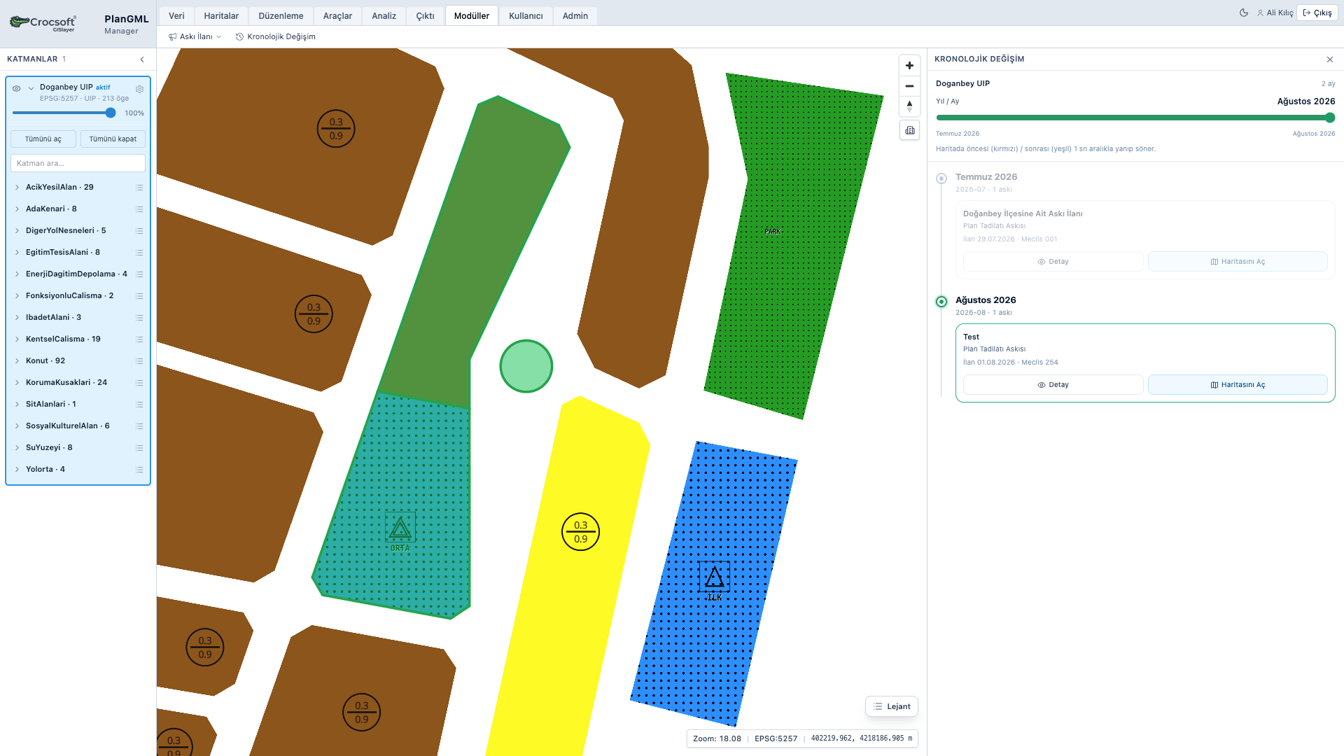 Chronological change log and 3D view
Published Zoning Map Demo: Yerköy Implementation Zoning Plan — live viewer
This link is a public map viewer demo of a published zoning plan. It is not the admin panel; management, drawing, editing, and publishing are done in the admin panel through a different interface. The demo above only shows the published plan’s viewer side.
Zoning Plan Manager is an end-to-end workspace for producing, correcting, managing, and sharing zoning plans. It is designed to reduce the daily workload of municipalities, planning offices, and consulting teams, catch errors early, and keep the plan visible in the same language both in the office and in the field.
The goal is simple: produce the plan correctly, fix it quickly, generate scaled output, and share it safely when needed. Teams can move NCZ source data into the PlanGML standard, run quality checks, keep styles consistent, apply bulk corrections, and manage public notice and publishing on a single platform.
Overview and Expertise
Zoning Plan Manager is designed to meet the following core needs:
- NCZ → PlanGML conversion: Import legacy NCZ or smart-geometry files; export and share PlanGML-compliant data.
- NCZ enrichment: Point-to-polygon conversion, building layout matching, FAR/coverage matching, and road-width matching; automatic enrichment for repeating rules.
- Quality control: Schema and content checks with PlanGML test tools; find faulty elements via filtering.
- Geometry editing: Type conversion, merge (tevhid), subdivision (ifraz), corner smoothing; justified bulk attribute updates.
- Live map feedback: Drawing, style, or visibility changes reflected instantly on the map and legend.
- Scaled output: Scale-selectable PDF with title, north arrow, scale bar, legend, and print-area preview.
- Central style management: Style catalogs for UIP, NIP, and CDP; fill, stroke, symbol, and pattern control.
- Zoning-specific drawing: Smart road drawing, zoning blocks, sidewalks, block edges/facades, and intersections.
- Measure and locate: Area and length measurement, point capture, and go-to-coordinate.
- Analysis and decision support: Land-use analysis, development rights (FAR/coverage), conflict analysis, buffer queries.
- Sharing and public notice: Permission-controlled project sharing, public viewer page, notice management, and chronological change history.
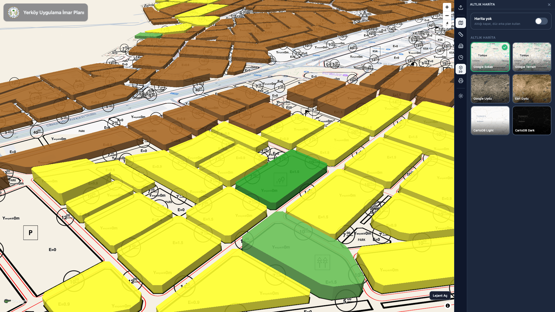
- 3D view: Clearer building-height context in three dimensions.
This structure turns the plan from a pile of files into a continuously up-to-date, controllable, and shareable work product.
Technology and Tools
The platform is built on a modern web and GIS stack. Key components include:
- PlanGML-aligned data model and schema validation
- NCZ import, enrichment, and PlanGML export tools
- Interactive vector map with live editing and legend sync
- Style catalog (fill, stroke, symbol, pattern) and atlas refresh
- Bulk attribute update, filtering, and matching engine
- Scaled PDF / image output engine (title, north arrow, scale bar, legend)
- Permission-controlled project sharing and public viewer page
- Public notice, chronological change log, and 3D view modules
- Architecture open to enterprise integrations via REST API
It can be extended with institutional authentication, archive, and basemap services as needed.
Process and Approach
A typical workflow can be summarized as:
- Data intake: NCZ (legacy or smart geometry) files are imported; enrichment matches building layout, FAR/coverage, and road widths when needed.
- Standardization: Data is made PlanGML-compliant; quality control runs schema and content tests.
- Edit and produce: Merge, subdivision, type conversion, and road/block/sidewalk tools complete the plan; bulk updates remove inconsistencies.
- Style and appearance: Central catalogs standardize UIP/NIP/CDP appearance; legend and pattern visibility are tuned.
- Analysis: Land use, development rights, conflicts, and buffer queries support decisions.
- Output: Scaled PDF and image outputs are prepared for meetings, notices, or approvals.
- Share and notice: The project is shared with permissions or published; notices are recorded and chronological changes tracked.
Applications and Use Cases
The platform delivers value in scenarios such as:
- Municipal zoning and planning units: Daily plan production, correction, notice, and publishing in one environment.
- Planning offices and consultancies: NCZ-to-PlanGML migration, quality control, and scaled delivery packages.
- Zoning plan authors: Catalog-bound drawing, merge/subdivision, road–block–sidewalk production, and style consistency.
- Notice and approval processes: Notice records, public viewer pages, and PDF presentation outputs.
- Multi-stakeholder projects: Permission-controlled collaboration with live map updates for team coordination.
- Management and audit: Chronological change history, quality reports, and analysis summaries for traceability.
Customization and Flexibility
- Style catalogs: Institution-specific fill, stroke, symbol, and pattern definitions; templates by plan type (UIP/NIP/CDP).
- Enrichment rules: Project-level rules for building layout, FAR/coverage, road width, and point–polygon matching.
- Permission matrix: View/edit project sharing with role-based access.
- Viewer tools: Legend, measure, symbol/pattern visibility, area analysis, and PDF options.
- Output templates: Page orientation, title, north arrow, scale, and legend layout customized per institution.
Support and Maintenance
To keep the solution reliable and up to date:
- Version and bug updates are managed in a planned patch cycle.
- Configuration and training aim for fast user adoption.
- When needed, second-level support and customization requests can use technical communication channels.
Pricing Types
Institution-based proposals are recommended based on user count, module scope (e.g. PlanGML editing only, or full enrichment + notice + publish), integration depth, and support SLA. Example packaging:
- Source Code Delivery: Code is installed on the institution’s server under non-redistribution terms; data stays on premises.
- Software as a Service: Data is hosted on Crocsoft servers under an annual license model.
Contact our sales team for detailed pricing.
Collaboration and Contact
In projects we aim for the right scope and realistic delivery dates through:
- Regular status sharing and clear acceptance criteria,
- Close work with institutional process owners (zoning, planning, IT),
- Pre-release pilot user feedback.
Compliance and Standards
System design is grounded in:
- PlanGML schema and content compliance (via test / quality-control tools),
- Controlled transition from NCZ source data to standard output,
- Style consistency across UIP, NIP, and CDP plan types,
- Traceability in notice and publishing workflows (chronological change log)
(final compliance reporting is produced per institutional requirements).
Zoning Plan Manager helps teams move NCZ data to a standard, catch errors early, accelerate with bulk tools, keep styles institutionally consistent, and manage scaled output / notice / publishing on one platform.
What you gain at a glance
- Move NCZ data to a standard → Import + enrichment + PlanGML export
- Catch errors too late → Tests, quality control, live map feedback
- One-by-one correction burden → Bulk update and matching tools
- Inconsistent appearance → Central style management
- Presentation / notice / report → Scaled PDF and publish page
- Team coordination → Permissioned sharing and live current view
The right plan is produced faster with the right tool. Contact us for your institutional zoning plan workflows.


Don't hesitate to contact us
At our IT solution company, we are committed to exceptional service and support for your business needs.
Get in Touch